Transit Oriented Development as a Solution to Indian Cities
1. Introduction
Global trends suggest that the pace of urbanization, a shift in
population from rural to urban residency, is growing. Considering the case of India itself, now competing with the fastest
growing countries of the world, the urbanization level has grown from 17.29% in
1951 to 31.6% in 2011
This brings up a need for accommodating more inhabitants and providing for their basic amenities, which in turn results into inevitable expansion of cities. This expansion, in many cases, is horizontal and unplanned. This unrestricted expansion of housing and commercial development, and even road infrastructure, is referred to as an urban sprawl. Even though urban sprawl may have a few pros such as increased local economic growth, there are immense amounts of drawbacks too; such as loss of agricultural capacity, higher taxes, increased runoff into rivers and lakes, harmful effects on human health, decrease in social capital and loss of natural habitats, wildlife and open space. Moreover, the odds of residents having inadequate access to infrastructure are higher, thus driving the city into auto-dependency, which in turn leads to a higher carbon footprint, hence making the urban growth rather unsustainable.

Figure 1. The Philadelphia metropolitan region has developed unevenly, and land consumption has outpaced population growth. (Source : https://philadelphiaencyclopedia.org/archive/sprawl/)
To counter the issue of urban sprawl and its consequences, various cities are coming up with Mass Rapid Transit systems (MRTS), such as metro rails, BRTS etc. Insertion of such transit systems should account for its availability to all user groups, in terms of affordability and access. Hence, such insertion into an existing city results into Development Oriented Transit (DOT), but its accessibility and efficiency is still in debate. In case of developing cities, development is focused along the transit routes. This could lead into a Transit Oriented Development (TOD) or Transit adjacent development (TAD). A TAD is development that is physically near transit, in order to promote transit riding, but it fails to capitalize upon this proximity. A TAD lacks any functional connectivity to transit—be it land-use composition, means of station access, or site design. TOD is the opposite, it strives to capitalize on the land adjacent and up-to a one-quarter mile from the stop.
Transit Oriented Development (TOD)
TOD
is a planned insertion into a city, and according to
Calthorpe

Figure 2.
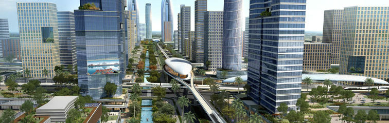
TOD is an urban design paradigm that has the potential to achieve urban
competitiveness, environmental sustainability, and social equity. TOD is the key for low-carbon and compact development with mixed land
uses and allows for optimized development along a transit corridor to maximize
the return on investments. It strategically increases densities and places
high-rises along the transit corridors to accommodate a wide variety of uses.
Contrary to DOT, in TOD planning for the population is done in accordance to
the transit systems. Typically, the transit stop or station is considered as
the centre, around which a relatively dense development is planned such that it
involves mixed-use residential and commercial areas. This density progressively
reduces with distance. "TODs generally are
located within a radius of 400 to 800 m from a transit stop, as this is
considered to be an appropriate walking distance for pedestrians, which solves
the last mile connectivity."
Indian cities face a massive amount of issues such as
severe congestion; deteriorating air quality due to increasing greenhouse gas
emissions from the transport sector; increasing road accidents; and an
exploding growth in the number of private vehicles.
“The Government of India would encourage Transit Oriented
Development (TOD) with increased [Floor Area Ratio] FAR along transit corridors
with high density of population should form a part of planning” (Ministry of
Urban Development 2014).
3.1 Key components of TOD
As per the policies followed in the master plan of Delhi, 2021
3.1.1 Pedestrian and cycle-friendly
environment
Improved pedestrian and cycle friendly streets would mean less of
auto-dependency even for last mile connectivity, hence saving on travel costs
and lessening road congestion. This would also cater to the population of the
lower income groups and make public transport more accessible to them. Creating
street-level activity and vibrant urban spaces making all streets and public
spaces universally accessible are vital. Helsinki in Finland, hopes to make car ownership “obsolete” by 2025. The
city intends to develop a network of dense, walkable and interconnected
neighborhoods and prioritize active transport.
3.1.2 Connectivity
Disperse high traffic volumes of traffic over a network of streets
rather than concentrating traffic on few major streets and junctions. Provide
the shortest route to pedestrians and non-motorized modes to station as well as
between individual buildings/complexes. Integrate infrastructure development
and travel demand management (TDM) strategies.
3.1.3 Multi-modal interchange
Minimize travel time and cost for majority of commuters and provide
multiple travel mode options with safety, affordability and accessibility.
Minimize the number and time required for mode transfers. Prioritize
pedestrians, public transport, intermediate Public Transport(IPT) and NMT modes
over private modes in design and management of urban spaces.
3.1.4 High-density, mixed-income
development
High density and mixed-use development along
TOD corridors with interconnected street networks makes average trip lengths
shorter, thus promoting walkability and use of non-motorized modes of
transport, hence reducing travel costs.
3.2 Economical Benefits of TOD
Public money expenditure reduces due to reduced
investments in infrastructure such as road expansions and other costs
associated with low-density sprawl. Increased land revenues along transit
corridors can in-turn be used for cross-subsidy and maintenance of public
transport.
3.3 Social Benefits of TOD
A variety of high density, mixed-se,
mixed-income housing and employment is made available within walkable
distances.
4.1 Delhi, India: Transforming
region and transportation
Unlike Curitiba, Delhi is an
already existing development that is now rapidly growing and currently accounts
for about 1500 sq.km land area. Increasing infrastructure such as highways has
led to increased auto-dependency which in-turn lead to increased environmental
and economic degradation. Since the late 1990’s, Delhi has invested heavily in
Mass Rapid Transit systems - mainly the Metro Rail and a BRTS, that is now
defunct, to reverse the traffic congestion and worsening air-quality. Post the
metro investments, the development pattern in Delhi was subjected to either
development oriented transit (DOT) or transit adjacent development (TAD).
Recently, in 2015, the planning agency (Delhi Development Authority or DDA)
made a conscious effort to develop a comprehensive Transit Oriented Development
Policy to redevelop station areas and neighborhoods along the Metro corridors.
4.1.1 Context
With a population of over 16.7 million persons (Census,2011), Delhi stands as the second most populous urban area in the country after the Mumbai Metropolitan Region. From 1951 to 2001, Delhi has seen a decadal growth of 50% per decade, higher than any other urban area, much of this being in the city’s outer areas such as East Delhi, Noida, Ghaziabad and Gurgaon.

Figure 3. Urban growth of Delhi (NIUA, 2015) (Source: NIUA)
Public transportation is now less preferred due to
the lack of connectivity (in particular to Metro stations), abundant subsidized
parking options as well as a lack of safety for walkers, cyclists and women in
the city.
4.1.3 Delhi Metro
Delhi Metro Rail Corporation (DMRC) opened its first corridor between Shahdara in east Delhi and Tis Hazari in north Delhi on 25th December, 2002, and today, it has crossed the boundaries of Delhi to reach Noida and Ghaziabad (Uttar Pradesh) and Gurgaon (Haryana). It provided relief from the road congestion by accommodating the growing number of commuters along the existing corridors. Despite the operational success of the metro system in Delhi, this mass transit system is yet to infuse new service infrastructure and guide urban growth along the metro corridors.
4.1.4 Introducing
TOD in Delhi
Delhi is looking at TOD as a solution to its mobility and air quality challenges, with the policy capturing the essential elements of mixed-use development, non-motorized transport and pedestrian priority, and encouraging a walk-to-work culture. Recognising the urgent need for Delhi to be prepared to receive huge in-migrations by 2021, the TOD Policy was created and approved by the Ministry of Urban Development on July 14, 2015. The norms will combine design, density and diversity to facilitate more people to live, work and seek entertainment along a well- connected and efficient mass transit system. The policy is still to be finalised. Delhi’s Transit Oriented Development Policy Draft of 2012 covers following key components:

Figure 4. Land Use Map of Delhi
Good
pedestrian and cycling/NMT facilities are promoted to reduce dependence on
motor vehicles for short trips and induce modal shift. The policy attempts to
promote pedestrian activities and amenities for pedestrian, NMT and public
transport with safety, convenience and universal accessibility.
The
number and the time required for transfer between different modes, have to be
minimised for maximum commuters. Reliable, frequent and affordable public transport
systems across the city are to be ensured. Private parking are to be priced and
limited appropriately to discourage private vehicle use in TOD catchment areas.
Densification
through redevelopment and infill within existing urban areas is to be prioritised
over development in urban extension. Underutilisation of FAR (below 3.0) is not
permissible for any new or redevelopment projects. The policy also mentions
that higher FAR would be an effective tool only for the redevelopment of
low-density and/or dilapidated neighbourhoods existing along transit stations.
All
projects and sites within TOD influence zones may have a mix of uses. At least
30% residential and 20% Commercial & Institutional use of FAR is mandatory
in every new/redevelopment project within the Influence Zone.
To
ensure efficient and optimum use of land, social amenities shall no longer be
given to individual plots of land within the influence zone. Instead, they
shall be allocated the required built-up area within planned redevelopment schemes
as per Masterplan requirements. As for open Space requirements for the
residential population, they may be provided on site.
4.1.5 Shortcomings
Integration of multi modal transport systems is poor. Feeder services are available only at selected stations and pedestrians and the NMT are amongst the most neglected ones. The metro terminals are situated outside the city boundary and act as development nodes, which in turn promoted the outward growth of the city, thus supporting sprawl.
4.3 Ahmedabad, India: An
incremental approach to TOD
The TOD in Ahmedabad resulted with the existing BRTS system, Janmarg, and the proposed metro system acting as a catalyst. The proposed MRTS is intended to be a solution to the declining ridership on public transit. The TOD is planned with an objective to curb sprawl by promoting a compact city structure with higher densities in zones with good access to public transit. Ahmedabad demonstrates an incremental approach to the implementation of TOD.
4.3.1 Context
Ahmedabad is the seventh largest metropolis in India, and the largest city in Gujarat with a population of 5.57 million in an area of 450 square kilometres (Registrar General of India 2011). It is located on the Delhi Mumbai Industrial Corridor (DMIC), which in turn creates a large potential for investment, industrialisation and development.

4.3.2 Ahmedabad Metro
Ahmedabad Metro is a rapid transit system for the cities of Ahmedabad and Gandhinagar and is under construction since March 2015 and being built by Gujarat Metro Rail Corporation (GMRC). Partial commercial operation of Phase-1 from Vastral Gam to Apparel Park on blue line was inaugurated on 4th March 2019 and is the 12th metro system in India to be operational.
4.3.3 Ahmedabad BRTS- Janmarg
It was inaugurated in October 2009, and the network expanded to 89 kilometres by December 2015 with daily ridership of 1,32,000 passengers. It is operated by Ahmedabad Janmarg Limited (AJL), a subsidiary of Ahmedabad Municipal Corporation. Phase-1 was between RTO-Pirana covering a distance of 12.5 km and open to public in 2009 while second phase, covering 84 km with additional 4 Km elevated corridors, was recently completed in 2014. The third phase is under progress. It was designed to connect recreational zones, educational zones and other important areas along the corridors.

4.3.4 Introducing
TOD in Ahmedabad
The
MRTS corridor has an impact on the land-use and housing policies of the city,
especially the regions under the Development Plan (DP). While the base FSI is
1.8, the Transit-Oriented Zone (TOZ, a 400m wide band around the BRT network
and proposed metro rail) is allowed a higher FSI of 4 and the central business
district in close proximity to the two networks is allowed a much higher FSI of
5.4.


4.3.5 Shortcomings
The capacity of BRTS to incorporate a radical shift from private to public transport is yet to be taken care of. Hitherto, there has been a shift of about 8% to public transport. User experiences suggest that the BRT system is yet to reach the fringe areas and internal pockets in the city. Slum redevelopment resulted in the working class population being located away from the CBD, increasing the trip length to commute to work. The proposal to extend BRT to the east part of the city poses a challenge for the city authorities to decongest and manage the existing high densities in the area.
Article by Maithreyi Nair:
Maithreyi is a architect from SMEF Brick School of Architecture, Pune, worked on undergraduate thesis project based on urban agriculture.
Throughout her academic journey, she have focused on experimenting with
different design philosophies and processes, as well as varied digital media,
so as to broaden her knowledge on various possibilities of the design outcome. She determine it
keeping in mind the eventual function and efficient performance of the space,
in terms of the user and environment. Form, then follows, these parameters. She
aim to keep experimenting on these lines and become better each time.
Related Articles

AVAILABILITY OF PUBLIC TRANSPORTATION: IMPORTANT IN DEVELOPING CITIES - By MITASHA DUGGAL
 Mitasha Duggal